These are the names on Thomas Holme’s map with surnames starting in T through Y. (There were no names starting with Z.)
I have identified these to the best of my ability, based on the available records, but names or places might be wrong. Some people just don’t show up on very many records.
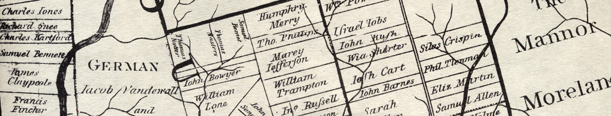
Notice that some people owned more than one tract in a township or multiple tracts in different townships. Also note that names sometimes differed significantly in spelling. Some names are garbled because of an error by Holme, and others by the engraver in London (who was probably not personally familiar with any of these people).
There were only three counties in 1687: Philadelphia, Bucks and Chester. Later the southern part of Chester was made into Delaware County, and the northern part of Philadelphia County was made into Montgomery County. To make it easier to find names on the map, I included all five of the county names, even though they did not all exist in 1687.
Most of the names on the map are easy to identify, allowing for small differences in spelling. I only made an entry in the fourth column if the name was significantly different.
| Name | Township | County | Name on map if significantly different |
| Taylor, Christopher | Bristol, Newtown, Northampton (2) | Bucks | |
| Taylor, Israel | Newtown | Bucks | |
| Taylor, Peter | Upper Providence | Delaware | |
| Taylor, Robt | Marple, Springfield | Delaware | |
| Taylor, Thomas | Birmingham, Middletown | Delaware | |
| Taylor, William | Upper Providence | Delaware | |
| Thatcher, Richard | Middletown, Northampton | Bucks | |
| Thomas, Charles | Oxford | Phila | |
| Tibby, John | Byberry | Phila | |
| Tomkins, Anthony | Northampton | Bucks | |
| Torten, Henreck | Ridley | Delaware | |
| Town, John | Middletown | Bucks | |
| Townsend, Richard | Chester, Bristol, Plymouth | Delaware, Phila | |
| Tucker, Richard | Darby | Delaware | |
| Tully, John | Bristol | Bucks | |
| Turner, Edward | Thornbury | Chester | |
| Turner, Robert | Northampton, Gwynedd, Kens/Richmond, Lower Dublin, Roxborough | Bucks, Phila | |
| Urin, Hans [Geörgen] | Darby | Delaware | |
| Vandewall, Jacob & Co | Germantown | Phila | |
| Venables, William | Falls | Bucks | |
| Vernon, Randal | Nether Providence | Delaware | |
| Vernon, Robert | Nether Providence | Delaware | |
| Vernon, Thomas | Nether Providence | Delaware | |
| Vickris, Richard | Makefield, Warrington, Roxborough | Bucks, Phila | Vicaris |
| Vincent, Sir Mathias | Vincent | Chester | |
| Vos, Mathias | Kingsessing | Von | |
| Vrouzen, Adrian | Vincent | Chester | |
| Waddy, Henry | Oxford (2) | Phila | |
| Wade, Robert | Chester (2) | Delaware | |
| Waite, James | Edgmont | Delaware | Waight |
| Waite, John | Goshen | Chester | |
| Walker, Francis | Bensalem | Bucks | |
| Wall, Richard | Cheltenham | Montg | |
| Walley, Shadrach | Newtown | Bucks | Walle |
| Walmsley, Elizabeth | Northampton | Bucks | |
| Waln, Nicholas | Middletown, Northampton | Bucks | |
| Walter, Godwin | Concord | Delaware | |
| Ward, Ralph | Middletown | Bucks | |
| Weaver, Anthony | Aston | Delaware | |
| Webb, Richard | Charlestown | Chester | |
| West, John | Cheltenham | Montg | |
| Wharley, Abraham | Newtown | Bucks | Whorley |
| Wharly, Daniel & Mary | Northampton | Bucks | Wherly |
| Wheeler, Gilbert | Falls | Bucks | |
| Wheeler, John | Falls | Bucks | |
| Whitacre, Charles | Edgmont, Ridley | Delaware | Wheetacar |
| Whitby, Thomas | Darby, Edgmont | Delaware | |
| White, George | Middletown | Bucks | |
| White, John | Middletown | Bucks | |
| Whitehead, Benj | Bristol | Phila | |
| Whitpaine, Richard | Westtown, Whitpain | Chester | |
| Wiggins, Wm | Middletown | Bucks | |
| Wilcox, Barnabas | Westtown, Bristol | Chester, Phila | |
| Willard, George | Warwick, Marple (D) | Bucks, Delaware | |
| Williams, Dunk | Bensalem | Bucks | |
| Williamson, Daniel | Marple | Delaware | |
| Withers, Thomas | Chichester | Delaware | Wethers |
| Witscard, Jonathan | Falls | Bucks | |
| Wolfe, Thomas | Falls | Bucks | |
| Wood, George | Darby, Newtown | Delaware | |
| Wood, John | Falls | Bucks | |
| Wood, Richard | Southampton | Bucks | |
| Wood, William | Easttown (2), Darby (3), Merion | Chester, Delaware, Montg | |
| Woodmansee, William | Chester | Delaware | |
| Woodyard, George | Upper Providence | Delaware | |
| Woolam, Gilbert | Aston | Delaware | |
| Woolman, Sarah | Warminster | Bucks | Woolinne |
| Worrall, John | Middletown | Delaware | Nowell |
| Worrall, Peter | Marple | Delaware | |
| Worrall, Richard | Lower Dublin | Phila | |
| Worth, Thomas | Darby | Delaware | |
| Yardley, William | Makefield | Bucks | |
| Yarnall, Francis | Springfield | Delaware | |
| Yarnall, Phillip | Edgmont | Delaware | |
| Yocumb, Peter | Kingsessing | Phila | |
| Young, Thomas | Byberry | Phila |